Lidar - Unlock the Possibilities!
Who We Are
Aeroform Digital was formed to focus on making LiDAR (3D Laser Scanning) in nearly any setting possible - interior, exterior and aerial using UAV/UAS/Drone systems.
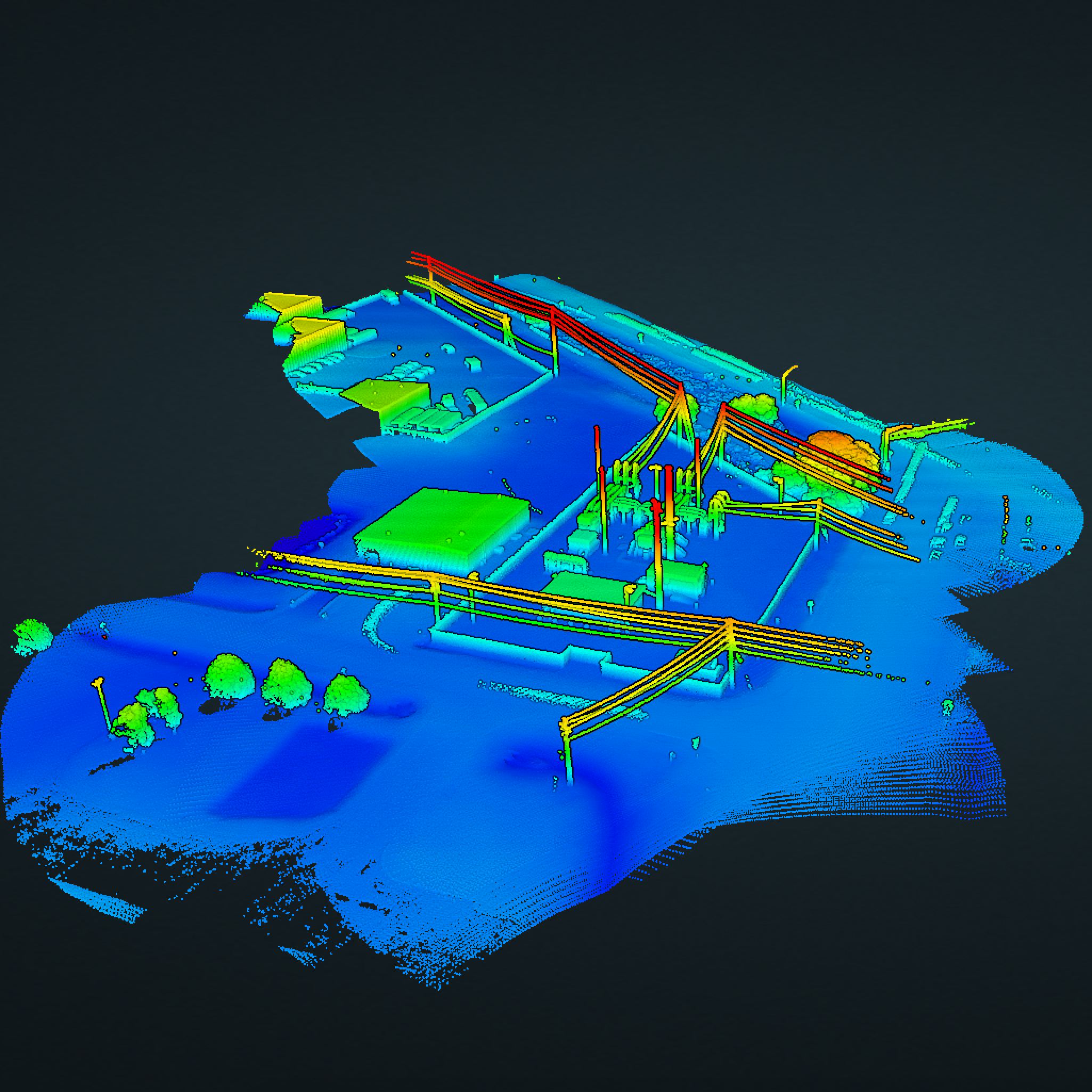
High definition 3D Laser Scanning analyzes and captures real world objects and environments to collect large amounts of data such as size, shape, and location in a very short time. The data can be registered into a unified point cloud and used to render digital 3D models or 2D drawings depicting and identifying real-world conditions in their current states. This gives the client a large amount of precise information that helps in the decision-making process at any stage in the project, helping to save time and reduce costs.
Services
Architectural / Structural
3D models of buildings / structures - As-built 3D models for new construction, historical preservation, etc.
Digital Elevation Models
- Topography capture for accurate contours and DEM
- Classify point clouds based on custom criteria
Volumetrics
Calculate accurate stockpile volumes using aerial LiDAR
2D / 3D Planimetrics
Classify 2D / 3D features into geo-located line drawings.
Reality Capture
Aeroform Digital uses state of the art imaging technology to capture dimensionally accurate 3D & 2D models of the real world.
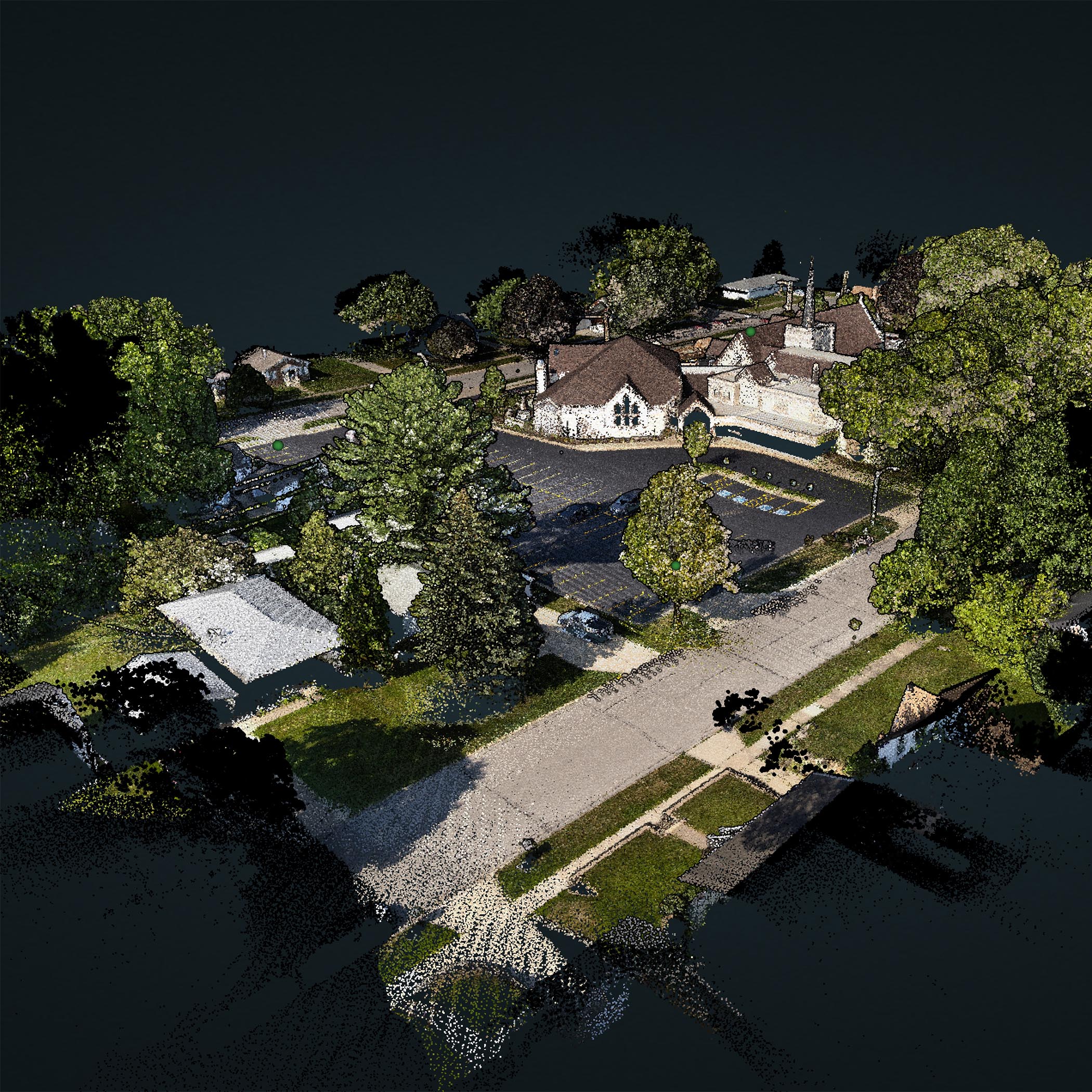
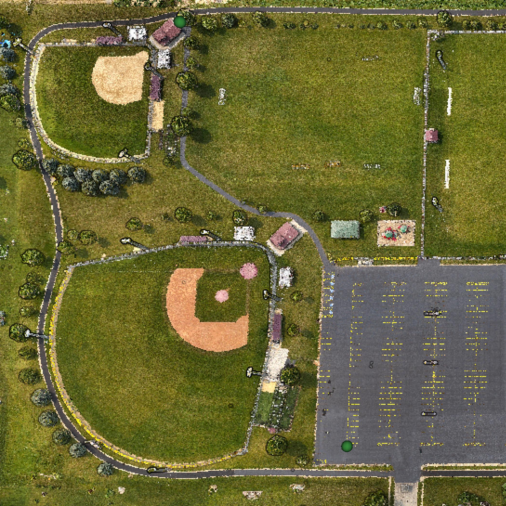
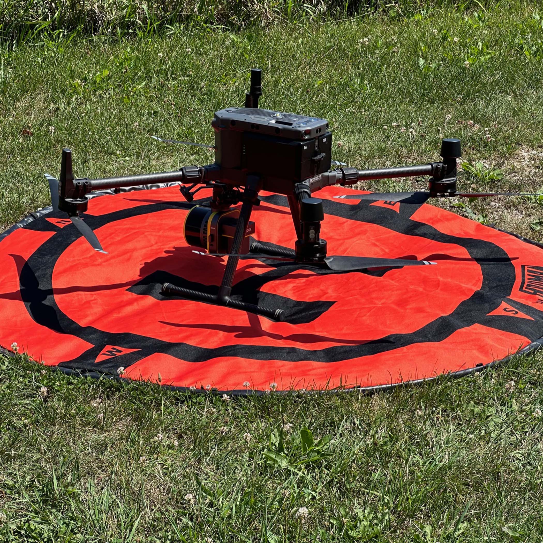
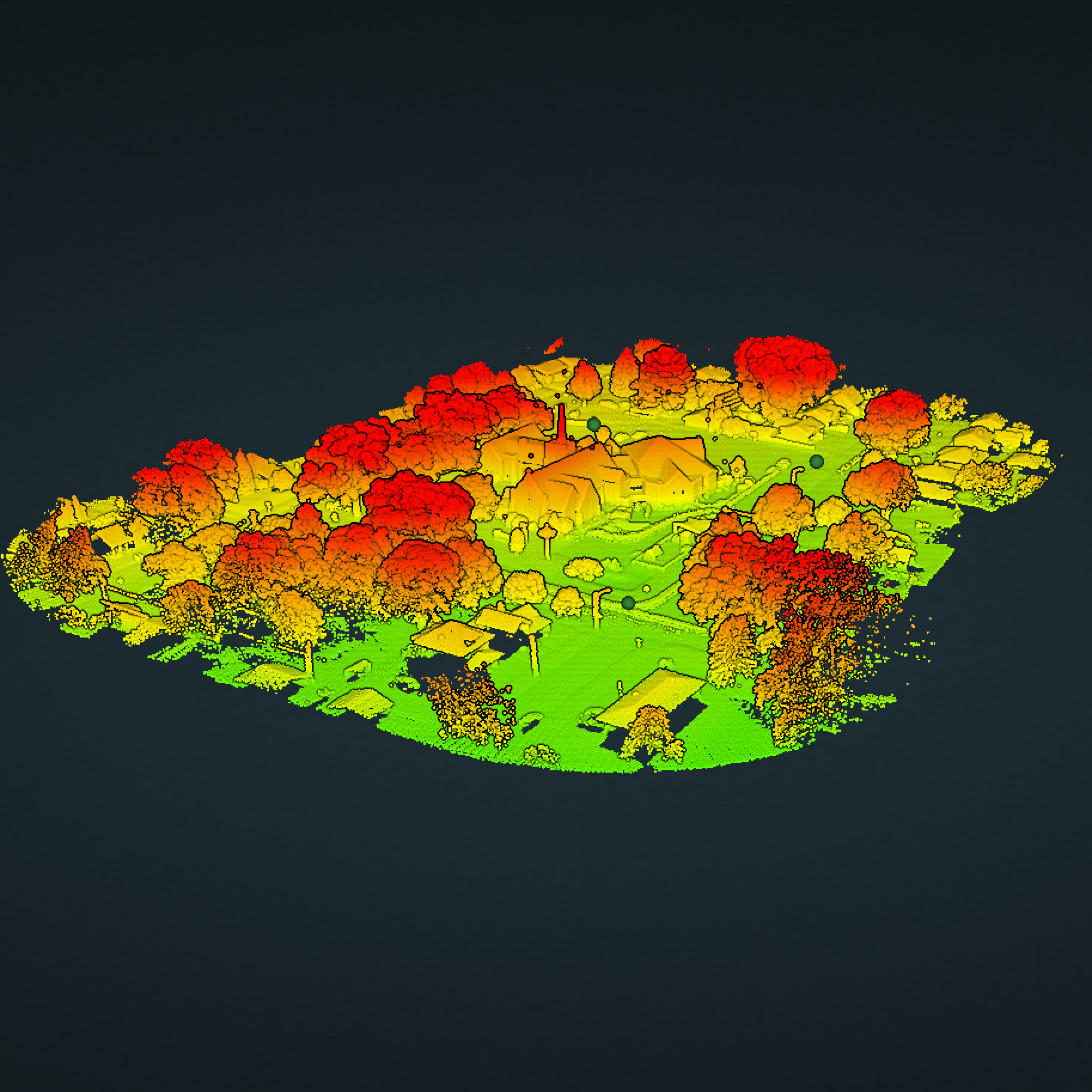
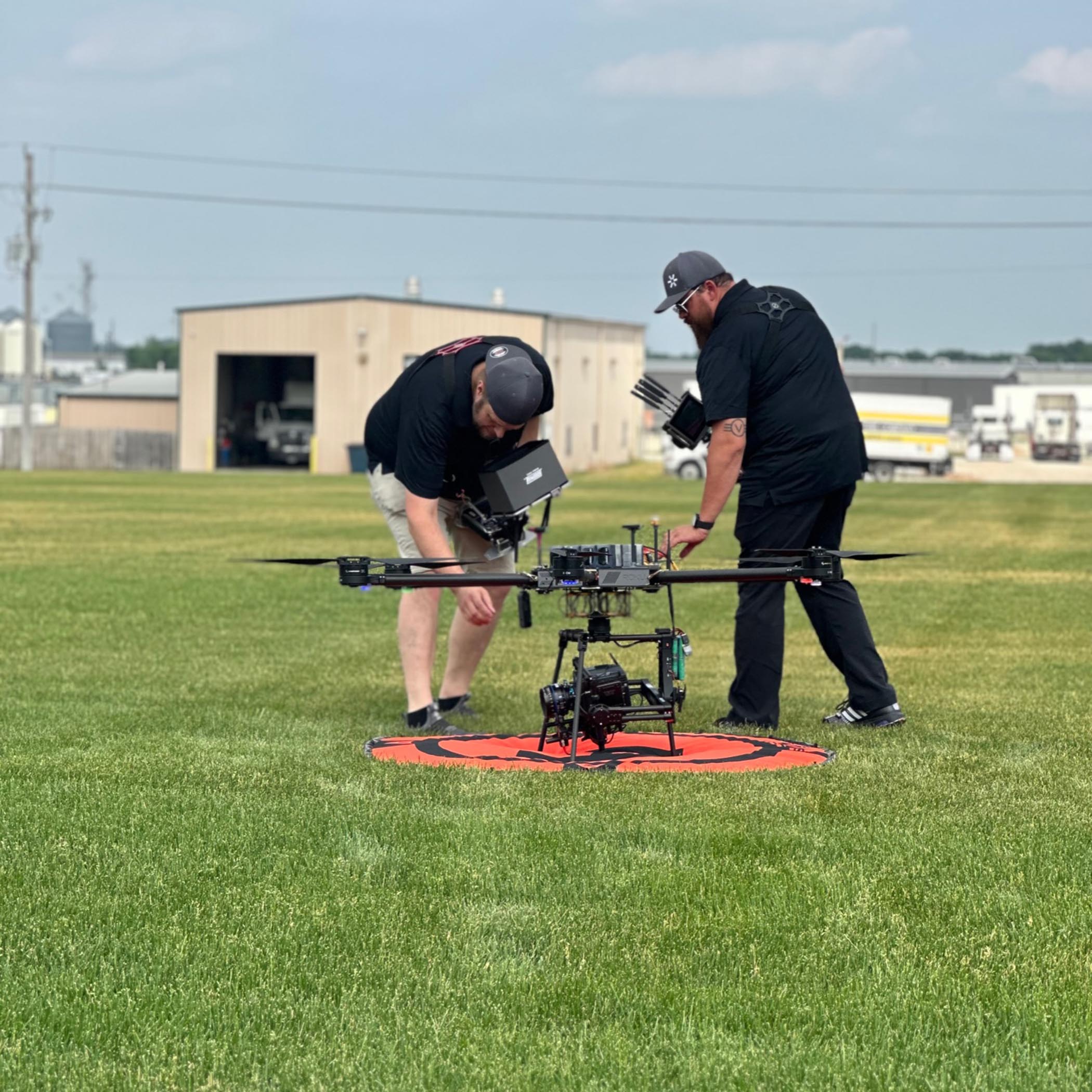
Through modern advancements in Uncrewed Aerial Systems (drone), LiDAR (3D Laser Scanning) and photogrammetry, Aeroform Digital can provide your firm with the spatial modeling data you need. Using the Rock Robotic 3rd generation R3Pro line of LiDAR sensors, survey grade accuracies can be achieved capturing1.28 million points per second.
About Us
Aeroform Digital’s founders, Chadwick Case and Ben Stineman draw on their experience in the photography and technology industries to offer unique and specialized spatial and reality capture solutions using modern LiDAR (Light Detection and Ranging) and photogrammetry. Aerform’s sole purpose is to capture the most accurate data possible using the latest in autonomous vehicle technology from the air or on the ground.